Arunachal Pradesh
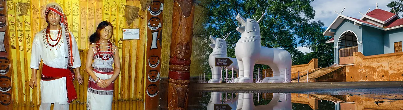
Arunachal Pradesh is the easternmost state of India. Arunachal Pradesh means "land of the dawn lit mountains" in Sanskrit. It is also known as "land of the rising sun” due to its position as the easternmost state. Nearly 60 % of the people belong to major tribes. The people have a tradition which is diverse and of rich culture, language and beliefs. It attracts tourists from all over the world. Tourist attractions include the Namdapha tiger project in Changlang district, Sela Lake near to Bomdila, Malinithan in Lekhabali and Rukhmininagar near Roing, Parshuram Kund in Lohit district rare wilderness experience. The array of flora and fauna will sure impress any tourist. Wildlife, trekking, angling, birding, rafting and trekking are also available. The state bird is Horn Bill, state animal is Mithun, state flower is Fox tail orchid and state tree is Hollong. It is the richest biogeographically interesting province of the Himalayan zone. A complex hill system with varying elevations ranging from 50m in the foot-hills to about 7000m, traversed throughout by a number of rivers and rivulets. Wildlife sanctuaries abound in rare species. Different tribal groups still live in their traditional villages.
Some of the popular circuits are -
- Tezpur - Bhalukpong - Bomdila - Tawang
- Tinsukia – Tezu - Parasuramkund
- Margherita – Miao - Namdapha
- Itanagar - Ziro - Daporijo - Along – Pashighat
- Roing - Mayudia – Anini
- Pasighat – Jengging – Yingkiong and the
- Tezpur – Seijosa (Pakhui) - Bhalukpong – Tipi.
General Information
- Latitudes : 26o 28' N and 29o 30' N
- Longitudes : 91o 30' E and 96o 30' E
- Area : 83,743 kilometer square
- Population : 1,091,117
- Population Density : 13 / kilometer square
- Male : 573951
- Female : 517166
- Capital : Itanagar
- Districts : 16
- Districts’ Names : Anjaw, Changlang, East Kameng, East Siang, Kurung Kumey, Lohit, Lower Dibang Valley, Lower Subansiri, Papum Pare, Tawang, Tirap, Upper Dibang Valley, Upper Subansiri, Upper Siang, West Kameng and West Siang
- Literacy : 54.74%
- Languages : English, Monpa, Apatani, Hill, Miri.
- Forest Area : 61,000 square kilometers
- Average Rainfall : 400 centimeter
- Temperature Average : 18° C - 20° C
- Highest Point : Kangto – 7090 meters, Nyegi kangsang – 7050 meters, Gorichen Main – 6488 meters and Gorichen : east 6222 meters.
- North Border : China
- West : Bhutan
- South : Assam
- South East : Nagaland
- East Border : Burma
- Major Tribes : Adi, Galo, Nishi, Khamti, Monpa and Apatani.
- Major Rivers : Brahmaputra, Kameng, Subansiri, Siang, Lohit & Tirap
Places to See in Arunachal Pradesh
- Itanagar
- Along
- Bomdila
- Daporijo
- Pashighat
- Roing
- Tezu (Parasuramkunda)
- Tawang (Tawang Monastry)
- Buddhist Gompa Tirap District
- Changlang (Land of Bio-Diversity) District
Adventure Activities in Arunachal Pradesh
- River Rafting: The Brahmaputra, Subansari, Lohit rivers
- Trekking: Se La Pass, Margherita railhead, Tawang, Bombdila
- Fishing and Angling: Pashighat, Bhalukpong, Tipi
Festivals and Fairs of Arunachal
- The Losar Festival (Jan/Feb)
- Torgya Festival
- Saka Dawa or Saga Dawa (fourth month of the Lunar calendar marks Gautama Buddha's achievement of Nirvana)
- Dupka Tse-Shi (sixth month of the Lunar calendar)
- Lhabab Duechen (In the 9th month of Monpa)
- Ganden Ngamchoe
Wildlife of Arunachal Pradesh
More than five hundred bird species have been recorded in Arunachal Pradesh, many of which are highly endangered and restricted to this state.
- Pakhui Wildlife Sanctuary (East Kameng)
- Itanagar Wildlife Sanctuary (Lower Subansiri)
- Mehao Wildlife Sanctuary (Dibang Valley Lohit)
- Kamlang Wildlife Sanctuary (Lohit)
Pilgrimage / Places of worship in Arunachal
- Parashuram Kund
- Bomdila Monastery
- Urguelling Monastery
- Tawang Monastery
- Malinithan Temple
Art and Craft of Arunachal Pradesh
- Handmade carpets
- Wooden Masks
- Pottery Painting
- Smithy Work
- Basketry
Dance and Music of Arunachal
- Aji Lamu (Monpa Tribe)
- Roppi (Nishing Tribe)
- Hiirii Khaniing (Apatani Tribe)
- Popir (Adi Tribe)
- Pasi Kongki (Adi)
- Chalo (Nocte Tribe)
Cuisine of Arunachal Pradesh
- Rice, Meat, Rice Beer, Paa-Saa (fish soup), Eka, Yi, Paro & Hikhu, Alyi Yo & Guiyang Hamang, Sihi Yo Sangkho, Momo, Thukpa, Gyapa, Khazi>
Connectivity of Arunachal
- By Air: The nearest airport is Lilabari in Assam, which is 67kms from Itanagar. Another important airport is Tezpur (Assam), which is 216kms from Itanagar and is connected to Kolkata.
- By Rail: The nearest railway station Harmuty, is only 33 km from Itanagar. Most convenient railhead is North Lakhimpur in Assam.
- By Road: Road network connects Itanagar with Guwahati (381 km), Shillong (481kms), Agartala (980kms), Kolkata (l,539kms) and other important cities in the region.
Important Information
STD Code : Itanagar 0360, Along 03783, Daporijo 03792, Bomdila 03782, Tawang Town 03794
Summer : March to May
Monsoon : May to September
Winter : October to February
Main Languages : Assamese, Bengali, Hindi, English

 visitnortheast.com